Navigation: an archived course and a lasting skill
The Navigation listing supplied for this article covered September 5–6, 2026. Those dates have passed, so this page is an archive, not an invitation to register for a new session. The supplied location field says “See event listing”; it should not be interpreted as a confirmed venue. The FeralSkills listing identifies a navigation class and links to its host. Readers considering a later edition should obtain current directions, equipment requirements and booking terms from that host. The following guide is independent editorial preparation for learning navigation, rather than a claim that every exercise described appeared in this particular course.
Replace a sense of direction with a record of decisions
People often describe navigation as an instinct: someone is good with directions, while someone else gets turned around. A more useful approach treats it as a sequence of observable decisions. You identify a starting location, choose a route, recognize checkpoints, notice whether the landscape agrees with the plan and reconsider before uncertainty becomes a larger problem. That sequence can be learned. It also makes mistakes easier to diagnose. If a walk went wrong, “I have no sense of direction” does not suggest a repair. “I passed the expected junction without checking its sign” does.
Start by considering an ordinary local trail rather than an impressive wilderness destination. Choose a route you already know, obtain a map covering it and explain the trip aloud. Identify the trailhead, the first junction, a clear landmark, the return route and the point at which you will decide whether there is enough daylight to continue. Familiar terrain removes some pressure, leaving attention available for the map. A navigation course then becomes a place to improve that explanation and test your observations, rather than the first time you have tried to connect paper with ground.
Read the map before touching the compass
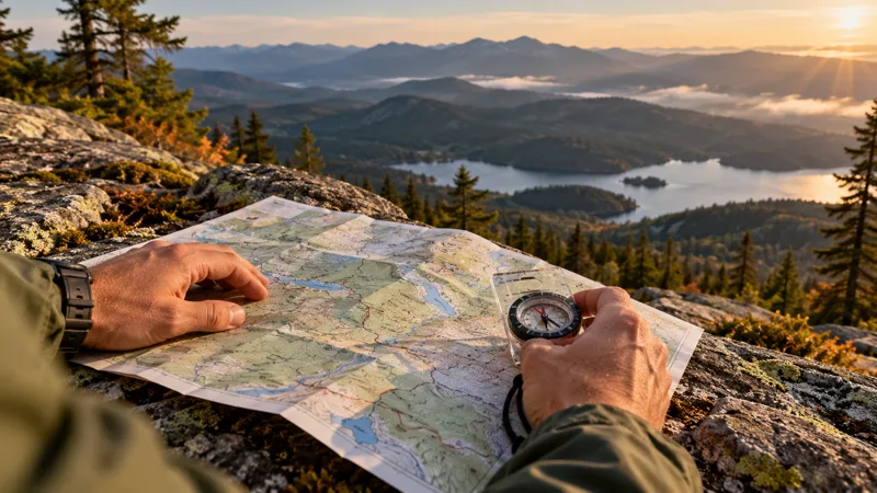
A compass cannot compensate for misunderstanding the document beside it. Before class, inspect the map title, legend, scale, coverage and publication information. Ask whether the instructor wants a particular map or will provide one. Roads, trails, water features and boundaries may use symbols that are different from the map you remember at school. Learning those symbols at a table is easier than deciphering them in rain. Trace the intended route with a finger and name the features you expect to encounter. Where possible, check current access information separately; a printed trail is not proof that it is open today.
Scale deserves its own exercise. Compare the distance between two known places with the distance represented on the map. Then think about what the measurement leaves out. A line does not fully describe hills, rough footing, pauses, crossings or the speed of the slowest member of a group. Route estimates should therefore be treated as working assumptions to review during the trip. An apparently short route can consume the day when conditions or group needs differ from the original estimate. Explain your uncertainty rather than presenting a precise arrival time as a guarantee.
Make compass instruction specific
Bring the model requested by the course instead of assuming that every compass is interchangeable. An instructor may use a baseplate compass for demonstrations, and following those demonstrations with a different type can add unnecessary confusion. Check that markings are readable, the housing is intact and you understand which components move. Ask the instructor to explain magnetic north, map north and the correction appropriate to the map and location. These are subjects for hands-on instruction, not details to guess from a generic internet diagram. Write down the explanation in your own words and ask someone qualified to review it.
A useful question is, “What observations would tell me that I have made a mistake?” That question encourages more than repeating a bearing. You might have selected the wrong starting point, confused one junction with another or held equipment in a way that affects its reading. Ask how the instructor checks an answer and what level of uncertainty is acceptable for the exercise. The goal is a method you can repeat deliberately. Successfully arriving at a marker by following another student does not demonstrate that you can explain or reproduce the navigation yourself.
Give electronic navigation a defined role
A phone can be an excellent planning and location tool, but decide in advance what it is responsible for. Will it show the route, record the track, provide emergency contact information or all three? Downloading a map is only part of preparation. Confirm that the relevant area is available without service, that you can open it and that you recognize what the display is showing. Check the device while stationary in a safe place. Do not allow a moving dot to replace looking at trail signs and the terrain around you.
Power planning should reflect actual use. A phone left on continuously for navigation may behave differently from the same phone carried in a pocket for occasional calls. Try your intended setup during a short local outing. Record how much power it uses and whether the screen remains readable in the conditions you expect. A battery pack needs the correct cable and its own charge. Paper mapping has different vulnerabilities, particularly moisture and loss. Backups become more useful when their failure modes differ, rather than when two devices rely on the same battery or unavailable service.
Use checkpoints to keep uncertainty small
Break a route into recognizable sections. A junction, bridge, signed trail entrance or distinctive terrain feature can provide a chance to compare the plan with reality. The checkpoint should be meaningful on both the map and the ground; an arbitrary distance on a screen may be difficult to recognize without electronics. Before leaving a checkpoint, describe the next section and what you expect at its end. This habit discourages drifting along while mentally somewhere else. It also gives companions a shared description of the route instead of leaving all knowledge with one person.
Choose checkpoints that suit your experience. An expert may interpret subtle changes in terrain; a beginner should initially use obvious features under supervision. Ask how to recognize a missed checkpoint and where the exercise boundaries are. Do not turn a training session into an unsupervised search for increasingly obscure landmarks. When observations disagree, pause and involve the instructor. The learning opportunity lies in understanding the discrepancy, not in quietly correcting your position after following someone else. Keep notes about the assumption that failed and the evidence that exposed it.
Plan the return as carefully as the outward walk
Many people study the destination and barely consider coming back. The return route may look unfamiliar when approached from another direction, and a junction that was obvious in daylight can be confusing later. During a supervised practice walk, occasionally look back from a safe stopping place and describe what the route looks like in reverse. Notice signs that face only one direction. Save enough attention for the later part of the outing, when conversation, fatigue and confidence can reduce the checks you made carefully at the beginning.
A return plan also needs a time decision. Set a review point based on the actual group, available daylight and conditions rather than on a desire to finish the planned route. Discuss who can call for a change and make clear that raising a concern is helpful. A group can create pressure to continue even when nobody has checked the remaining distance. A written turnaround decision gives everyone permission to reconsider. The destination is optional; returning with sufficient time and energy is part of the navigation task.
Practice communication, not just instrument use
For a group exercise, take turns explaining location and the next move. One person can identify a feature while another checks the map, but each should understand what the group believes. Avoid vague directions such as “over there” when a more specific description is possible. Ask whether everyone agrees on the feature being discussed. A clear statement of uncertainty is more useful than pretending to know: “I recognize the junction, but I have not confirmed which branch we are on” invites a targeted check.
Before a real trip, leave an itinerary with a trusted contact and agree on when they should seek help if you fail to return. The National Park Service trip-planning guide offers a useful framework for organizing a trip and emergency information. Adapt that framework to the land manager and activity involved. A contact who knows only that you went hiking has much less useful information than one who knows the starting point, route, vehicle and expected return. If plans change, update the contact when practical.
Choose purchases after identifying the friction
Navigation equipment should solve a specific problem. If the map becomes unreadable when wet, protecting it may be a better first purchase than another electronic device. If your compass markings are too small to read comfortably, fit and readability deserve attention. If you struggle to interpret terrain, more expensive hardware is unlikely to fix the central issue. Ask to handle equipment before buying and compare it against the instructor's requirements. Keep the initial system simple enough that you can explain every component and find it without unpacking everything.
After training, schedule another short practice session rather than leaving the materials untouched for months. Write a route explanation, test it in familiar surroundings and record what you still cannot explain. Progress might mean recognizing a junction sooner, estimating a leg more realistically or making a timely decision to turn around. Those improvements are valuable even if the outing is modest. Navigation confidence should grow from repeated checks that agree with the landscape. The archived September class is a reference point; the durable benefit is a habit of knowing what evidence supports your next step.