Archived event: These dates have passed as of October 7, 2026. This page retains the original listing for reference; consult the provider for later offerings.
Land Navigation was listed for September 27, 2026 in See event listing.
This is an archived event listing. These dates have passed; do not use this page as confirmation of a future edition.
Event details
- Dates: September 27, 2026
- Location: See event listing
- Type: Land Navigation
View the event source and registration information
Read the location gap before planning travel
Land Navigation was listed for September 27, 2026, with the location recorded as “See event listing.” This is an archived entry. The directory names BigPig Outdoors and links to its website, but a provider's home town is not necessarily the venue of a particular class. This page deliberately retains the location gap instead of filling it with a guess. For another offering, obtain a complete meeting address and directions from the provider. Navigation preparation begins here: knowing the difference between a place associated with an organization and the place where you are actually expected to arrive.
The independent guide below focuses on the habits that make navigation training useful. It is not a substitute for supervised instruction or a route plan for an unfamiliar area. A course may cover particular tools and techniques, but those details need confirmation for the session you book. Your goal before enrolling should be to describe what you want to understand. Are you confused by a map's symbols, uncertain about relating a map to the ground, or overly dependent on an app? A specific learning problem gives you a better basis for choosing instruction than an adventurous course title alone.
Study the map as a document
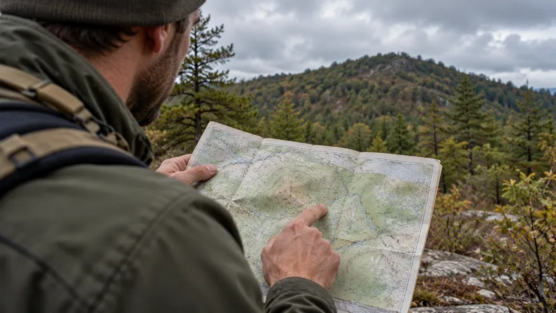
A map has a purpose, an extent, a date, and a set of conventions. Before interpreting it, ask what information it is designed to present and what might be absent. The United States Geological Survey describes topographic maps as representing terrain and features through mapping conventions, including contour information. That general explanation is a useful starting reference, but the map used in your class may have its own legend and details. Read those carefully. A symbol that seems intuitive should still be checked. Confidence in a guess is different from understanding the document in front of you.
Look for the map's publication information and ask how the instructor evaluates whether it is suitable for the intended activity. A map can remain valuable while some features have changed. A road, access arrangement, or facility shown on it may need current confirmation from the relevant authority. Record that uncertainty rather than ignoring the map or treating it as automatically current. The same principle applies to a digital layer. A screen can feel authoritative because it is interactive, yet it still presents information with a source, purpose, and possible limitations that deserve review.
Connect observations to evidence
A useful navigation exercise asks you to explain why you believe a feature on the ground corresponds with a feature on the map. Notice the evidence you use and the evidence still missing. In a supervised setting, ask the instructor to check your reasoning before relying on it. Avoid accepting one convenient resemblance as complete confirmation. Several features may look similar, and a familiar-looking path can still lead somewhere different. Your notebook should describe the comparison rather than merely recording that you “found the place.” That distinction reveals how the conclusion was reached.
Practice describing an observation plainly: what you can see, which direction you are considering, and why the match seems plausible. Let the instructor introduce the appropriate technical vocabulary rather than using terms you only partly understand. If you discover your conclusion was wrong, record what made it attractive and what evidence corrected it. That review is one of the most useful outcomes of a controlled exercise. A mistake discussed in class can improve your process; a mistake hidden to save face may remain a habit until it causes trouble in a less forgiving setting.
Ask about the equipment before buying it
Confirm which map, compass, or digital tools the provider uses and what students must bring. Similar products can differ in ways that affect instruction. Ask whether loan equipment is available and whether your existing item is appropriate. You may not need to purchase anything before a first lesson. Bring model information when requesting advice. An instructor can answer a concrete compatibility question more clearly than a broad request for the “best” tool. Keep the focus on learning the functions and limitations needed for the course rather than assembling a sophisticated-looking collection.
If a phone is part of the class, ask about the exact app or format and the preparation required. Do not assume that installing an app provides the data needed for the exercise. Confirm with the provider and the software's documentation what should be available beforehand. The same care applies to paper materials: arrive with the correct version and protect it according to the expected conditions. Familiarity with your own screen, controls, and storage routine can prevent avoidable distraction. Equipment preparation should make the lesson easier to follow, not replace the lesson with self-directed experimentation.
Give the group a shared vocabulary
People can use the same location words while imagining different places. Before an outing, agree on names for the actual meeting points and landmarks relevant to the plan. Use the provider's directions during class. In a later group activity, make sure each person can explain the agreed destination and return arrangement. “Back at the parking area” is unclear when there are several lots. A useful group plan identifies the intended place precisely enough for everyone to recognize it. Clarity matters more than sounding technical, especially when participants have different levels of experience.
During supervised practice, observe how the instructor manages decisions between participants. Does each person explain their interpretation, or does one confident voice control the exercise? A learning group benefits from hearing the reasoning before reaching agreement. This does not mean turning every choice into an endless debate. It means following the instructor's process and using uncertainty as a chance to ask a focused question. If your understanding differs from the group, say so at the appropriate time. Silent disagreement can hide a useful lesson and leave you unsure why the final choice was made.
Plan the day's boundaries
Ask about the actual duration, terrain, physical demands, weather policy, and movement boundaries for a future class. The archived directory's times do not establish the arrangements of another offering. Confirm the procedure for requesting assistance, taking a break, or leaving early. A navigation lesson may involve outdoor practice, but it is still an organized event with defined responsibilities. Do not head beyond the assigned area because you want a harder challenge. The instructor needs to know where participants are and what exercise they are completing. Staying within the plan supports both learning and supervision.
Prepare ordinary necessities according to the provider's list and your personal needs. Suitable clothing, a manageable pack, food, water, and any prescribed personal items are logistics to resolve before class. Avoid making the lesson your first test of unfamiliar footwear or a complicated carrying system. Discomfort can occupy the attention you need for observation. If the physical requirements are uncertain, ask instead of assuming. A suitable accommodation or alternative session may be possible. The strongest preparation is an honest match between the learning conditions and your ability to take part comfortably and responsibly.
Treat timing as information
A route plan is not only a line between places. It also includes when the group starts, what it expects to accomplish, and when it intends to return. Ask the instructor how timing fits into the methods taught. Keep a record of the assumptions used in an exercise and what actually happened. If a short task takes longer than expected, explore why. Perhaps the group spent time interpreting the map or locating a clear reference. That finding can improve later planning. It should not lead you to rush a future task simply to match an unrealistic estimate.
For your own ordinary outings, share the agreed itinerary with a suitable contact and discuss what a delay would mean. Keep the arrangement appropriate to the activity and local guidance. Do not assume someone at home automatically understands when to act or which information they would need. A conversation before departure can expose uncertainty while there is time to clarify it. Navigation competence works alongside communication and group planning. Carrying the right map does not remove the need for people to know where you intended to be and what your return arrangement actually was.
Review digital convenience without dismissing it
A digital tool can be useful, but it should be understood rather than trusted by habit. Ask what the display shows, which information comes from the device, and which comes from a map source. Discuss limitations with the instructor and consult the relevant documentation. Do not interpret a moving symbol as proof that every route shown is accessible or suitable. The teaching goal is to relate the tool's information to the actual situation and approved plan. You can appreciate convenience while retaining the ability to recognize an assumption that needs confirmation.
Similarly, avoid treating paper as automatically sufficient just because it does not need a battery. A paper map is useful only when the user can interpret it and when it is appropriate to the area and activity. Ask how the course combines different sources of information, and record the roles each plays. You may discover that your main difficulty is conceptual rather than technological. Replacing one tool with another will not resolve a misunderstood legend or an unclear group destination. Addressing the underlying question gives you a more transferable skill and makes later equipment choices more deliberate.
Build a local follow-up that stays within your competence
After class, ask the instructor for a suitable beginner practice exercise in a familiar, permitted setting. Keep the scope small and the boundaries clear. A follow-up might involve reviewing a map with known features rather than traveling into unfamiliar terrain. If your notes leave a critical concept unclear, seek clarification first. Record the exercise's purpose and what you learned. Progress is not measured by how far you go from help; it is measured by the quality of the reasoning and the reliability of the process you can explain.
Return to the archived Land Navigation entry for its historical date and source, and to the provider for future class details. The most important lesson of this page begins with its incomplete venue: do not invent information simply because you want a complete plan. Ask, verify, and make the gap visible until it is resolved. That habit continues through map study, observation, equipment use, communication, and review. A responsible navigator becomes better at distinguishing what is known from what is assumed, then choosing an appropriate next step instead of allowing confidence to outrun the available evidence.