Land Navigation For Hikers was listed for October 3–4, 2026. The recorded location is “See event listing,” rather than a confirmed training address. As of October 7, this is an archived session; the dates have passed and this page does not confirm a replacement class.
What the source establishes
- Recorded dates: October 3–4, 2026.
- Recorded location: see event listing.
- Subject category: land navigation.
- Source page: Land Navigation For Hikers on FeralSkills.
The source identifies Texas Survival School as the host and provides a registration link. It does not establish a detailed navigation syllabus on the page reviewed here. The guide that follows discusses independent learning priorities for hikers. It is not a reconstruction of the October class or a claim that particular instruments, routes, or assessments were used.
The aim is to keep the journey understandable
Navigation is often pictured as someone standing with a compass and calculating a direction. For hikers, its broader purpose is to keep location, route, time, and available choices understandable throughout a journey. A person may know how to manipulate an instrument yet still miss a junction, overlook a route closure, or continue beyond a sensible turnaround because the day feels successful so far.
A useful course should help you connect measurements with decisions. Knowing where you think you are matters because it affects what comes next: which feature should appear, how much travel remains, and when an observation should make you reconsider. Ask a future instructor how the course links map interpretation, field observations, and route planning. A list of equipment skills alone may not show that connection.
Start with the kinds of hiking you actually do. Someone who mainly walks signed paths needs dependable habits for checking junctions and recognizing when a trail description no longer fits. A person moving in areas with fewer established routes may need more extensive supervised training. Neither should assume that the most complicated exercise is the most relevant next lesson.
A map has a language and a publication history
The US Geological Survey explains that topographic maps use contours to represent elevation and land shape, alongside other geographic features. That makes them useful for understanding terrain, but reading them requires attention to their scale, legend, and source. A symbol that seems intuitive may have a specific meaning, and a feature visible in the field may not appear in the particular map edition.
Before a trip, identify the map's coverage and whether your route extends beyond it. Check how detail changes between products. A broad overview may be excellent for seeing regional relationships while omitting the detail needed at a complicated junction. A close view can show local features but make it harder to understand alternatives beyond the screen or page. These are complementary uses rather than a competition between map types.
Publication age deserves scrutiny too. Roads, access arrangements, paths, and place names can change. A historical map may be interesting without being suitable as the primary planning reference. Use current land-manager information for closures and permissions, and ask a qualified instructor how to compare map data with present conditions. A line drawn on a map is not permission to enter private property or proof that a route remains usable.
Plan observations, not just a destination
Imagine a supported walk that passes a bridge, follows the edge of a meadow, and reaches a junction before returning. Those features can form a sequence you expect to recognize. If the meadow arrives before the bridge, or the junction looks materially different from your notes, the mismatch deserves attention. You do not need to wait until you feel completely lost before asking whether the route interpretation is wrong.
A route plan can include questions for each stage: What will confirm progress? What would suggest that I have missed the intended turn? Where is there an established safe place to pause and reassess? Which parts depend on weather, access, or the group's pace? A qualified course can help you select useful observations for the terrain rather than adopting a universal formula that ignores the setting.
Time estimates are also hypotheses. A party may move more slowly because of steep ground, frequent stops, or a participant's condition. Treat the estimate as something to compare against reality, not a promise to defend. A shorter route with a clear return can be a better practice choice than an ambitious loop whose schedule leaves no room for instruction or ordinary delays.
Paper and screens fail differently
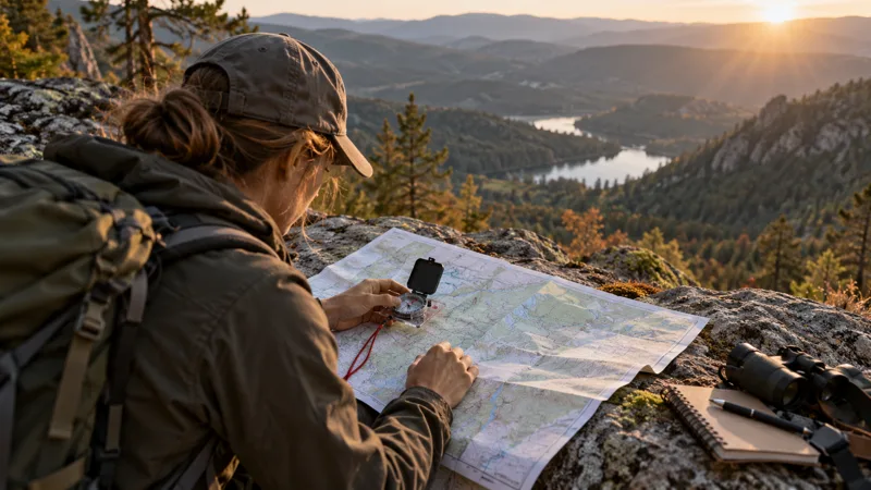
A paper map gives a stable overview and does not require a charged battery, but it needs suitable coverage, protection, and the ability to interpret what is printed. A phone can offer convenient position information and multiple map layers, but availability depends on the device, stored data, settings, and remaining power. Familiarity with both formats helps you notice their limits rather than expecting either to solve every problem automatically.
Before travel, verify that needed digital information is actually accessible under the conditions you expect. Opening an application at home with a strong connection does not establish that all map content is stored for later use. Follow the application's documentation and check the intended map area while you still have support. Protect the device from damage and consider what information remains available if it becomes unusable.
For paper, inspect the print rather than assuming any listing is satisfactory. Can you read the relevant labels? Is the scale visible? Does folding hide a feature you will need? Will your protective cover let you examine the right area without awkward handling? These practical details are easy to resolve before an outing and frustrating to discover after rain, wind, or fading light complicates the task.
Learn compass use with the right reference
A compass is most useful when you understand the relationship between the instrument, the map, and the local setting. Instruction should address the relevant references and any necessary adjustments for the area and equipment. This article deliberately does not substitute a step sequence for hands-on teaching. Small misunderstandings can produce confidence without accuracy, particularly when a learner has watched a demonstration but not received feedback.
Choose an instrument with the provider's guidance. Ask whether a particular design is required, whether loan equipment is available, and what features are appropriate for the class. A more elaborate compass does not automatically make the learning easier. Clear markings, comfortable handling, and compatibility with the instruction may matter more than extra features you do not yet understand.
Also ask how the course deals with distractions and interference. Instruments and electronic devices should be used in accordance with their instructions, and a reading that disagrees with other evidence deserves investigation. The important habit is comparison: no isolated number should erase an obvious mismatch with the terrain or the known route. A competent navigator can say that a result needs checking. That statement is especially useful within a group, where an apparently precise reading may otherwise silence a sensible question. Invite someone else to describe the evidence they see before agreeing on the interpretation. Shared understanding is more valuable than a quick consensus built around the first confident voice.
Practice uncertainty without creating an emergency
Good practice can take place on a familiar, legal route with a companion or qualified instructor and clear limits. You can predict which visible features will appear, compare the prediction with the walk, and discuss differences at an established stop. The challenge is to improve your interpretation, not to remove support or intentionally become lost. A controlled learning environment makes mistakes easier to understand.
If real uncertainty develops, prioritize safety and appropriate assistance rather than turning the situation into an impromptu test. Follow local safety guidance, the group's plan, and professional advice when help is needed. Do not adopt generic advice to travel in a particular direction or follow a landscape feature without knowing the terrain and hazards. Navigation decisions are context dependent, especially near water, cliffs, roads, or inaccessible ground.
The National Park Service's outdoor essentials framework places navigation within a wider system of support. That perspective matters because knowing a position does not meet every need on a delayed outing. Clothing, lighting, communication arrangements, and supplies still influence available choices. Discuss the whole outing with your instructor instead of treating navigation equipment as a substitute for preparation.
Questions that reveal the teaching approach
Before a later class, ask whether instruction starts with map literacy, how much time is spent outdoors, and how participants receive feedback. Confirm any required prior experience and the physical demands of the practice route. Ask what happens when a learner needs a concept explained again. These answers help distinguish a useful introductory experience from a course pitched beyond your current foundation.
Because this archived listing lacks a confirmed venue, obtain exact directions and the meeting arrangements directly for any future session. The area determines which maps and reference information are relevant. Do not purchase a local map or book accommodation simply from a host's name. Resolve the location first, then build travel and equipment plans around the actual instructions.
After instruction, keep a record of the mistakes you can now recognize. Perhaps you check the legend sooner, notice a junction mismatch earlier, or compare elapsed time with your plan more deliberately. Those are tangible improvements. Use the event directory to find appropriate follow-up teaching, and continue with supported practice until the reasoning behind each decision is as familiar as the controls on your device.