Land Navigation Level 2: arrive ready to examine your assumptions
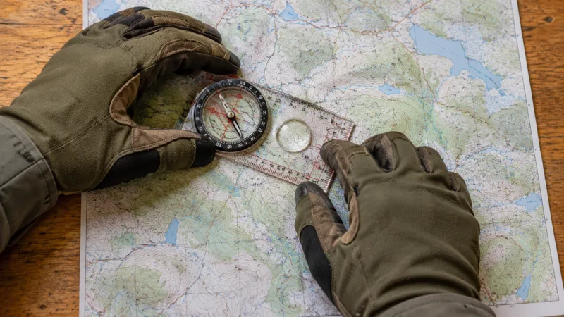
Land Navigation Level 2 – Mastering Advanced Map and Compass Skills is listed for October 9–11, 2026. The location in this listing is “See event listing,” so readers should obtain an exact meeting point before traveling. The FeralSkills entry identifies Nature Reliance School and describes a course intended for people who have completed its first navigation level. Confirm the provider's current prerequisite and registration arrangements directly. This independent preparation guide concentrates on evaluating route choices and uncertainty. It does not reproduce the course syllabus or provide instructions for attempting advanced solo exercises.
Check readiness with explanations rather than confidence
An advanced course works best when basic operations no longer consume every moment of attention. Before booking, ask which prior course or equivalent experience is accepted. Then review the material you learned rather than relying on the memory of completing it. Can you explain your map's scale, symbols and north references? Can you describe how you check a position and recognize a disagreement? If an answer is vague, identify it as a review need. The appropriate response may be preparation or a refresher, not abandoning the goal.
Choose a familiar route and explain how you would navigate it without actually leaving the established trail. Describe the starting point, checkpoints and return decision. Compare your explanation with someone who has relevant instruction. The exercise is useful because familiar terrain exposes how much knowledge you usually leave unstated. You might recognize a junction by habit but struggle to identify it on the map. Advanced learning becomes stronger when those gaps are visible before the instructor adds unfamiliar terrain, time estimates and more demanding decisions.
Give terrain interpretation a separate place in preparation
Map reading can become a symbol-recognition exercise if you never relate it to what travel would feel like. Ask your instructor how the course connects mapped terrain with observations in the field. In preparation, examine a familiar area and note where your usual walking pace changes, where visibility narrows and where a route choice becomes inconvenient. Do not infer that you can safely cross a feature simply because you recognize its symbol. Interpreting terrain should improve planning and caution as well as directional confidence.
Describe alternatives in plain language. One route may be longer but easier to follow, another more direct but dependent on subtle landmarks. Compare them for the actual group and conditions rather than declaring one universally superior. An advanced navigator should be able to explain the tradeoff to companions who do not share the same experience. If the explanation requires several untested assumptions, choose a simpler plan or seek guidance. Sophistication should reduce confusion, not justify a route that nobody else understands.
Make distance estimates accountable
A distance estimate is useful when you can explain what supports it and what might change it. Ask the provider which estimation methods will be practiced and how results are checked. Keep a record of your estimates during ordinary, safe outings on known routes. Include conditions such as stops, group pace and terrain. Do not convert one successful estimate into a rule for every situation. A method learned on a smooth path may require careful adjustment elsewhere, and instruction should help you understand that adjustment.
Use ranges where precision would be misleading. If you have little evidence for a travel-time estimate, saying “about two hours” can sound more certain than you intend. Explain the assumptions and define a review point instead. For example, the group can reassess progress at a known junction and change the plan if it is slower than expected. This approach keeps estimation connected to action. An elegant calculation has limited value if nobody notices that the real journey has departed from the conditions on which it depended.
Ask what evidence could prove you wrong
Confirmation is satisfying, but contradiction is often more informative. Before a training leg, identify the observation that would make you reconsider the chosen route. The landscape may fail to match the expected sequence, a junction may be absent or the elapsed time may become inconsistent with the plan. Ask how the instructor sets boundaries for exercises and when students should request help. Do not continue an unfamiliar route merely to avoid admitting uncertainty. Advanced instruction is a place to learn a disciplined response to disagreement.
During a debrief, separate a wrong conclusion from the reasoning that produced it. If you selected the wrong feature, ask which evidence you overlooked and how you could have checked earlier. If you were right by accident, acknowledge that too. Arriving at the intended marker does not automatically validate every decision along the way. Reliable navigation is supported by observations you can explain. This distinction makes feedback more useful and reduces the temptation to judge skill only by the final result of one exercise.
Handle electronic tools as sources of evidence
A GPS position or phone track can support a navigation decision, but interpret what it says rather than treating it as an order. Ask your instructor about the relationship between electronic information and the methods being taught. Confirm whether devices are permitted during particular exercises. If the course temporarily removes a tool for learning purposes, that does not establish that you should discard useful technology on real trips. A training constraint and a field safety plan serve different purposes and should be understood separately.
Review how maps are stored, updated and opened without service. Note whether a route file comes from a verified source and whether it matches current access information. An old track can show where someone traveled without proving that the route is presently open or appropriate. Test your equipment at home, including charging and readable display settings. Record the limitations that apply to your setup. The most useful electronic backup is one whose information and vulnerabilities you understand, not the one with the longest advertised feature list.
Keep natural-navigation claims in context
Some navigation programs discuss environmental indicators. If such a subject appears in your course, ask how the instructor validates it, what conditions affect it and when it should not be relied upon. Avoid converting an interesting observation into a universal rule. A tree, patch of vegetation or remembered story is not automatically a reliable directional instrument. Supervised learning should emphasize cross-checking and limitations. Until you understand the method and its appropriate setting, treat it as a question for the instructor rather than an independent travel plan.
The same care applies to techniques seen in entertainment or short videos. Ask whether the demonstration omits important context, such as location, time or a previously known position. A dramatic scene may make a complicated decision look immediate. Real planning gives you time to gather evidence and choose safer options. You do not need to prove independence from every tool. A more useful ambition is to recognize which information is dependable in the present situation and which assumptions need checking before the next movement.
Translate individual skill into group clarity
A person with advanced training can unintentionally make companions dependent by doing all the thinking silently. Practice explaining a route in a form the group can follow. State the next checkpoint, expected conditions and agreed review point. Invite questions about anything unclear. If another person has an observation that conflicts with yours, investigate it instead of dismissing it because your qualification is higher. Group navigation benefits from shared evidence. Experience should make the explanation clearer and the discussion safer, not end the conversation.
Consider what happens if the principal navigator becomes unavailable. Companions should know the itinerary and how to retrieve maps and contact information. For organized activities, responsibilities should follow the group's actual procedures and qualifications. The National Park Service trip-planning guide provides an official framework for organizing plans and emergency information. It is not a certification standard for this course. Use it to make the broader travel plan understandable to a trusted contact as well as to the people on the route.
Choose exercises with suitable boundaries
After a course, ask the instructor what practice is appropriate for your current ability. A safe progression may use familiar areas, clear boundaries and a partner before introducing more demanding conditions. Do not invent a solo night exercise because the course title says advanced. Confirm land access and local rules, choose ordinary conditions and keep an emergency plan. Learning should build evidence of competence in manageable steps. A large leap in difficulty can hide whether a problem came from the new technique, the environment or inadequate preparation.
Keep the purpose of each practice session narrow. You might evaluate your route description, compare a time estimate or check whether companions recognize the same checkpoint. Trying to test every method at once makes the review harder. Write the intended learning outcome before leaving and review it afterward. If you cannot explain the result, seek feedback rather than adding another gadget. A small exercise with a clear conclusion is more valuable than an ambitious outing whose success depends on luck or whose mistakes remain unexplained.
Leave with a calibration habit
Calibration means keeping confidence proportionate to evidence. Record what you can repeat reliably, what remains inconsistent and what conditions you have not practiced. Update those judgments after supervised feedback and ordinary outings. Avoid describing yourself as an expert because the next-level course felt successful. Navigation demands vary, and a sensible person can be confident in one setting while choosing additional support in another. That boundary is a sign of judgment, not a failure to learn.
The October Level 2 listing offers a chance to refine navigation beyond simple instrument familiarity. Confirm the exact venue and prerequisite, review your foundational knowledge and arrive with questions about uncertainty. The enduring benefit is a way of evaluating evidence before movement, explaining choices to others and noticing when a plan needs to change. A capable navigator does more than choose a direction. They keep the relationship between the map, terrain, group and available time visible enough that the next decision can be assessed.